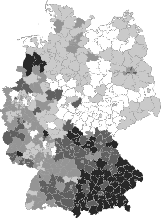
A mere 2.75 years after the fact, the Definitive Volume (TM) on the German Federal Election of 2009 is almost (almost!) ready to go to the printers’. And so is our chapter on East-West differences in German voting behaviour, which is vintage before it is even out (Pirate party, anyone?). Obviously, the details are becoming more and more blurry, so going through the proofs actually made for a pleasant read.
Political Science is the magpie amongst the social sciences, which borrows heavily from other disciplines. These days, many political scientists are actually failed economists (even more failed economists are actually economists, however). I used to think of myself as a failed sociologist, but reading the proofs it dawned on me that I might actually aspire to become a failed geographer.
On particular nice map that should have been discussed more thoroughly in the paper shows the local deviation from regional voting patterns. Yes, you read that right: I calculate an index (basically Pedersen’s) that summarises local (i.e. district level) deviations from the regional (East vs West) result and roll that into a choropleth. This way, it is easy to see how heterogeneous the two regions really are. Most striking (in my view) is the difference between Bavaria and the other Western Länder, which is of course a result of the CSU’s still relatively strong position. The PDS/Left party’s stronghold over the eastern districts of Berlin is clearly visible, too.
Discover more from kai arzheimer
Subscribe to get the latest posts sent to your email.


I’m trying to figure out what kind of failure I am. My best guess is “failured historian” 😉